To give life to a new development model and make the Lazio coast more competitive, the Lazio Region has recently made the control room of theSea Economy. The organization will bring together and dialogue the various entities present on the coast, to launch new integrated policies for the coast.
As part of these activities, the Region and the Navy have entered into an important public partnership agreement for cooperation and development of issues connected with innovation and research in the maritime field.
Specifically, the Hydrographic Institute of the Navy - Official cartographic body of the State designated for the production and updating of the official national nautical documentation - has developed, together with the general management of infrastructures, environment and housing policies of the Lazio Region, a project for the protection of the territory and the sea, the protection of the marine environment and the development of methods for monitoring the coast. The activities, which have already started and will end next year, are part of the European project POR - FESR INTERCOAST.
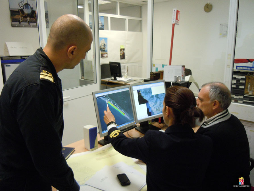
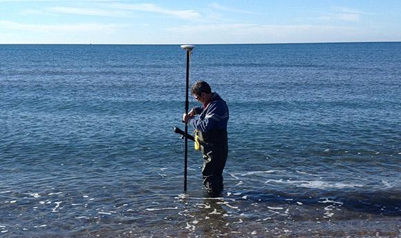
On 10 December, after a series of preparatory and joint research operations developed at the Hydrographic Institute and the Regional Infrastructure Directorate, an intense survey activity of the Lazio coast began, preparatory to the definition of the coastline and the of the shore.
The activity, aimed at defining the land-sea limit in the field on a linear development of about 20 km of sandy and rocky coast, is integrated with a series of cartographic operations that will serve to define how the coastline has evolved in the last decade in the region, over a total length of over 400 km.
The operational team in the field, composed of six operators and coordinated by professors Marco Pierozzi and Roberta Ivaldi of the Hydrographic Institute, carried out, from 10 to 20 December, geo-topographic and hydrographic operations to identify the shore line, topography and nature of the coastal area, using latest generation echo sounders and position detectors.
The acquired data, processed with software for graphic elaboration and enhancement of theHydrographic Institute, in addition to being used for the project, they will also be used to update the Institute's cartographic database.