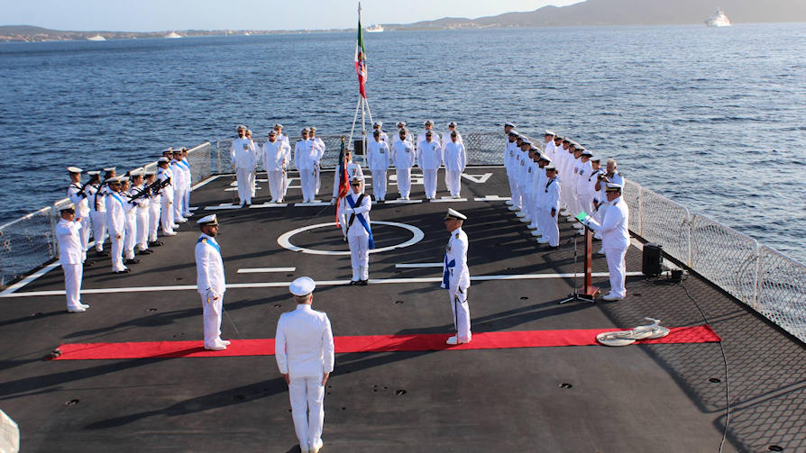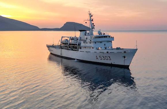
October 18th, Ship Admiral Magnaghi returned to the port of La Spezia concluding the 2023 hydro-oceanographic campaign.
This campaign involved three hydrographic units overall - Magnaghi, Arethusa e Galatea – develop a broad and structured program of activities. They operated in the Adriatic and Tyrrhenian seas to update seven different nautical charts of the sector's national cartographic portfolio and conducted, as usual, qualifying oceanographic monitoring.
Nave's contribution Magnaghi, under the command of frigate captain Stefano Derudas, saw the unit leave on 18 May from the La Spezia source, returning there after 150 days in which it was busy developing activities at sea functional to the updating of nautical charts number 24 and number 322 of the national cartographic portfolio.
Valuable result achieved in 2023 concerns the closure of the surveys relating to the updating of a nautical chart relating to a particularly complex sea area in terms of orography and seabed trend such as nautical chart number 24 - from Roccella Ionica to Capo Rizzuto; the culmination of a demanding multi-year work which had seen the unit operating for some time in the Ionian Calabrian waters.
During the campaign there was no lack of collaborations both with universities and with the hydro-oceanographic components of other navies and nations.
 From 26 to 28 July, the hydrographic staff on board was the protagonist of a project with the University of Bari which saw them operate in the waters of the Ionian Sea in front of the port of Taranto, in a sampling activity for the research of pollutants and microplastics in the water column and seabed sediments. International collaborations have instead seen the on-board specialist staff supported by an officer from the Albanian navy and three officers from the Tunisian navy, all certified hydrographers.
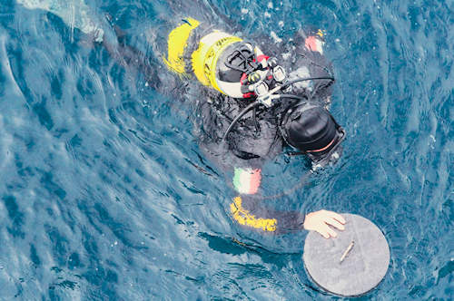
Thanks to the modern instrumentation on board for the three-dimensional mapping of the seabed, for the determination of the chemical-physical parameters of the water column and the direct sampling of the seabed, the ship Magnaghi was able to collect and validate data for the creation not only of cartographic products relating to the area of interest but also useful information for updating local nautical publications and for the study of both the nature of the seabed, with particular attention to its morphology , and tidal excursions. With techniques network real time kinematic (NRTK), which allow the use of GPS receivers to determine the position of objects on the ground, the coastlines were also reconstructed and the positions of the conspicuous points of the assigned maps were determined.
In the coming months, while the unit will stop for maintenance, the on-board hydrographers will be engaged in the second processing of the data acquired during the entire summer which, together with the initial data valorisation activities already carried out immediately following collection, will allow to correlate all the information detected and transform the "raw data" into finished products. These will then be shared with the Navy Hydrographic Institute which will first insert them into its databases and subsequently transform them into products and nautical charts essential for safe navigation.