The United States Navy continues to study data collected from underwater drones deployed in the Arctic Ocean to assess how fast the ice is melting - the goal is to identify new strategic waterways in the region.
The Office of Naval Research explained to Military scouts that the data collected will be used to develop new advanced forecasting models. The US Navy is currently updating the Arctic Road Map: Less ice in the Arctic means new stretches of sea and waterways. This will lead to an increase in maritime transport and a consequent and inevitable competition for natural resources such as oil and gas.
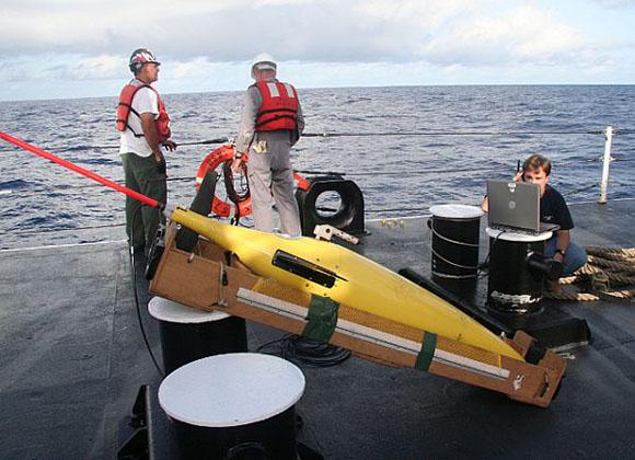
The Office of Naval Research reveals that since 2014, U.S. drones have been deployed to survey the marginal ice zone, the area occupied by the ice pack's edge and its melt waters. The idea behind the research is to evaluate the rate of change in the Arctic environment to better predict the rate of melting of the ice.
The data released by the Office of Naval Research are particularly interesting. In the summer of 2014, ONR had over XNUMX robotic platforms, mostly drones, in the Arctic ocean alone Seaglider. The latter have been programmed to receive acoustic signals from fixed submarine positions, so as to determine latitude and longitude for diving navigation. An assessment of climate change carried out by the task force of the Navy ruled that the dissolution rate has increased over time.
The Arctic is warming up twice as fast as the rest of the globe. Therefore, the Arctic Road Map needs to be updated following new scientific projections relating to the changing conditions of ice and water in the Arctic region.
(photo: US Navy)