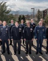
Twenty visitors, from all the armed forces, have obtained at the Aerocooperation school the qualification of "Remote sensing image interpreter", at the end of the 9 course RSI (Remote Sensing Interpreter).
In the five weeks of the course, the users were provided with the notions useful for obtaining an overall view of the "RADAR Imaging" and acquiring the skills necessary to analyze the information detected through sensors for photointerpretation purposes.
The CSR course represents one of the steps of the qualification process in the field of operational remote sensing, entirely carried out at the Aerocooperation school, which is completed with the frequency of higher level courses Remote Sensing Military Analyst (RSMA) e Geospatial Data Analyst (GDA).