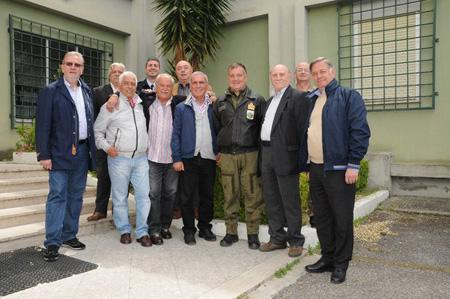
At a distance of 45 years, its visitors have decided to meet again at the Aeronautical Geotopographic Information Center (CIGA) which represents for them and not only the cartographic pole of the armed force.
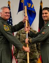
Welcomed by the director, Colonel Pierluigi Grimaldi, they met old colleagues still in service and the new generation of cartographers, reliving with them the origins of cartography. In a display case in which the historical relics are kept, they were able to review the nibs, the inkwells and the inks they used when the workmanship was still completely manual. In an exhibition set up along the corridors of the center, they reviewed the prototypes of maps and aeronautical charts. Subsequently, visiting the CIGA laboratories, they were able to appreciate the modern technology that made the work more functional, precise and versatile.
In the 70s, in view of the completion of the "Multi Role Combat Aircraft" (MRCA) Tornado program, the Armed Force realized that it had to set up a center capable of continuing the work carried out by the then state cartographic section. greater than aeronautics, making it more technological in the production process in order to support the new needs of weapon systems. Hence the decision to establish the first courses for non-commissioned officers "Cartographers" which in 1977 then merged into the nascent CIGA.
Since then, facing the new technological challenges, the center supports the armed force in the various exercises with a cartographic cell. It creates and distributes paper and digital maps to flight crews for planning stations, for flight simulators. It also collaborates with civil institutions in the event of disasters, for the fight against unauthorized building and illegal dumping thanks to the help of photointerpretation of aerial photos and satellite images.
The Aeronautical Geotopographic Information Center (CIGA) is the state's cartographic organ for aeronautical mapping. He works with staff belonging to various categories including the specific one of the "Cartographer".
Source: CIGA - Pratica di Mare (Rome) - lgt. Canio Martinelli