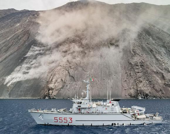
Last autumn, the Stromboli volcano produced a pyroclastic flow and a subsequent lava flow that traveled down the steep slope of the Sciara del Fuoco (SdF) to the coast. The lava flow dug a deep gully 930 m long, on average over 100 m wide and up to 70 m deep, which poured at least 3 million cubic meters of pyroclastic material removed from the slope into the sea.
This accumulation has made both the subaerial and underwater slopes particularly unstable, generating the probability of a possible collapse of a subaerial and/or submarine portion of the SdF with consequent formation of landslides, even large volumes, which could trigger tsunami waves with significant effects. on the coasts of the island of Stromboli and the other Aeolian islands, even reaching the northern Sicilian and western Calabrian coasts, as has happened at least 7 times in the last 150 years. The last tsunami occurred on 30 December 2002, when a tsunami wave originated which penetrated the coasts of the island, in the urban area, up to a height of approximately 10 meters above sea level.
In order to evaluate the increase in susceptibility to gravitational landslide of the submerged portion of the SdF which could trigger a tsunami wave which would once again hit the island and the neighboring coasts, theNational Institute of Geophysics and Volcanology (INGV) asked the Navy General Staff for the possibility of carrying out a bathymetric survey with unmanned underwater systems, given the danger from falling blocks and landslides that characterizes the marine area below the SdF.
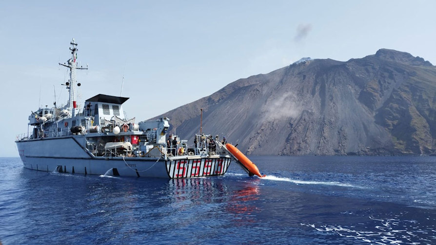
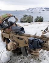
The 3rd department (Plans, Operations and Maritime Strategy) of the Navy general staff was therefore tasked with coordinating the planning of the activity in close collaboration with the INGV staff. To complete the important survey, the mine countermeasures unit, the Vieste, of the Navy.
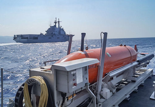
The unity of the class Lerici is equipped withAutonomous Underwater Vehicle (AUV) "HUGIN 1000", capable of fully autonomously carrying out a detailed analysis of the seabed up to 3000 meters deep by means of the highly sophisticated acoustic sensors on board.
Last 19 and 20 September it successfully completed the bathymetric data acquisition survey in the area in front of the Sciara del Fuoco, in accordance with the indications received from the INGV volcanologists, hosted on board the ship.
Thanks to the professionalism of the staff involved and by virtue of the good weather and sea conditions, the data acquisition was completed in just two days.
The data acquired at very high resolution will subsequently be processed, interpreted and compared with previous surveys carried out in the same area in order to identify significant bathymetric variations useful for highlighting the possible presence of morphological elements capable of increasing gravitational instability along the underwater portion of the SdF and the consequent ability to form tsunami waves.