Curiosity and the desire to explore have always distinguished the human soul and, with these impulses, humanity has found the courage to overcome the fear of the unknown, the real dangers and the terror of the imaginary monsters that populated the collective mentality. Intrepid navigators of the unknown have faced incredible storms and endless calms, crossing borders unthinkable for a time in which everyone believed that one had to fall into the void once one reached the end of the world. First they passed the Pillars of Hercules, then they went further and further, up to the American continent and, after overcoming a thousand difficulties and dangers, they circumnavigated the globe.
Christopher Columbus, Vasco da Gama, Bartolomeo Diaz, Ferdinand Magellan made it possible to draw the maps of a completely new world and scientific knowledge really began to progress when the seaways were opened that would connect the four corners of the Earth. The progress achieved in maritime navigation, in fact, has allowed humanity to enormously expand knowledge on this planet of ours and to spread notions, cultures and ideas.
The vast majority of people on Earth today have the full scale picture of our planet engraved in their minds. Today we all know that when the sun rises in Europe, it is still night in the United States or that when it is summer here, it is winter in the southern hemisphere. The world has now become a global village whose inhabitants, day after day, increase mutual dependence.
Yet, a few centuries ago this was not taken for granted and the path to reach today has not been easy.
Ancient navigation
 At the beginning of the life of peoples, the sea represented a barrier beyond which there was the unknown. However, driven by curiosity, the desire to explore, but also hunger, the need to reproduce, the need to find new resources, man faced unknowns and dangers, discovering new lands and new peoples beyond the sea and establishing the first maritime traffic which, with the progress of shipbuilding, expanded more and more.
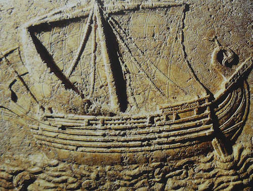
At the time of rowing navy mainly coastal traffic flourished in closed seas. The rowing navy could, in fact, be called a "home" means of navigation. The ships were tied to the coast, had poor seaworthiness and were not suited to long sea voyages. For these reasons they had to navigate non-continuously and subject to weather conditions and the length of the distances to be covered. Thus it was that the ships took to the sea during the "good season" and daytime navigation took place mainly through the recognition of coastal features (mountains, towns, watchtowers, gulfs, etc…) and night navigation looked up to the stars to understand if the route was the right one.
However, the maritime communications of the time allowed the diffusion of knowledge and a reasonable volume of traffic of precious and light goods, which greatly influenced the growth of maritime peoples, and not onlyi. The desire to know and explore the increasingly distant world subsequently allowed the development of shipbuilding techniques suitable for facing the open sea and the greater dangers associated with it.
The development of the sailing navy, thanks to a tireless and completely free propulsion method like the wind, marked the beginning of the race for ocean routes, along which the coasts were not visible for days on end. The gradual affirmation of sailing applied to offshore hulls has, in fact, allowed navigators to spread throughout the world.
The units had greater range and greater load capacity and, given the cheaper than sea transportation, a principle substantially still valid today, this also marked the beginning of real prosperity for the continental peoples.
However, the distance from the coast and the lack of certain reference points was for a long time a problem for navigators, who followed the routes more by heart and instinctively than with the mathematical certainty of their position, understood as a precise geographical point identified by latitude and longitude.
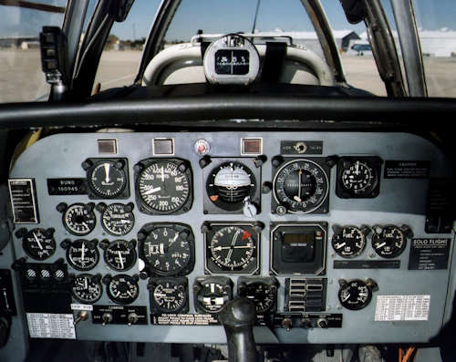
In the northern hemisphere, for example, during the night the latitude was easily known by measuring the "height" of the pole star, i.e. the angle formed between the direction of the marine horizon and the direction of the star, allowing the navigator to directly know his own latitude. At the equator, in fact, the height of the polar pole is equal to zero as it can be observed on the horizon line, and increases as the latitude increases up to the north pole, where its height is maximum and equal to 90° (above the our head). This was possible using optical instruments suitable for measuring the angles between two objects, which gradually evolved up to the end of the XNUMXth century, the sextantii marine. Through some mirrors that reflected the light of the star and suitable devices for reading the angle, the height of any object / star on the horizon was measured. However, the constant movement of the vessel made observation difficult and, when the sky was cloudy or in fog, it was practically impossible to take a measurement.
The calculation of longitude, on the other hand, for a long time represented the major nautical problem, as it was not directly deducible from stellar observations, because longitude is closely linked to time. Since the Earth completes a full 360-degree rotation in 24 hours, having a 15-degree difference in longitude means that the time is one hour up or down from the reference point. Knowing the time difference at which the same astronomical phenomenon occurs in two different locations therefore makes it possible to calculate the difference in longitude. That difference in time, measured in hours, minutes and seconds has, in fact, an equivalence in longitude and therefore represents the difference in longitude between the known point and one's position.
 All in all, the theoretical discourse is quite simple, but its practical application was not without technical difficulties, given the technology of the time. In order to make precise calculations, in fact, it was essential to ensure the precision of the time on board the ships, otherwise the data would not have been true.
Powder clocks (the term "hourglass" in Italian can sometimes also indicate the type water) were used only to mark life on board (changing of the watch, meals, etc…) and pocket watches were not suitable for calculating longitude because they did not ensure the necessary precision.
The indeterminacy of longitude, therefore, sometimes caused the dramatic end of navigation with shipwrecks, due to the fact that the actual position was not the one assumed. On 22 October 1707, for example, four British warships sank because they had calculated that they were still in the open sea, but during the night they suddenly found themselves on the coast of the Isles of Scilly, about 45 km southwest of Cornwall. The accident caused the loss of about two thousand sailors.
The exact calculation of longitude was possible only after the Englishman John Harrison, a mechanical genius, in 1764 invented the chronometer, i.e. a precise and portable clock that was not affected, for example, by temperature variations or accelerations due to movement of the ship. This represented a real turning point for the art of navigation. The importance of time accuracy became such that a watch service was set up at sea specifically to check that the chronometer was always running.
For the record, Harrison's invention was greatly opposed and only after a few years he managed to get full recognition ... and part of the substantial prize.
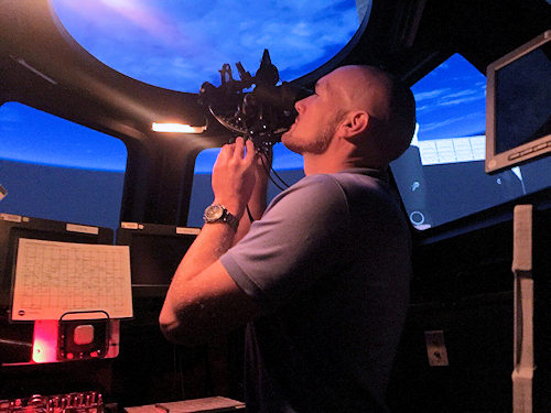
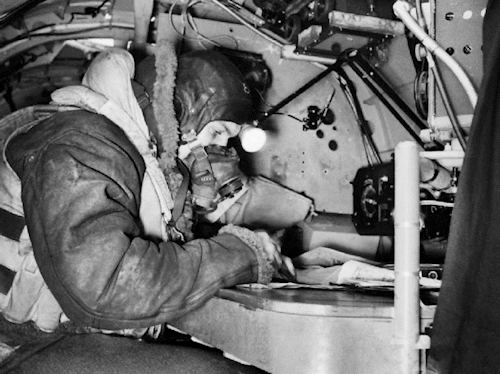 For centuries, observations of the stars have been the only way to calculate the position in the open sea, even after the advent and rapid spread of mechanical propulsion and subsequent rapid technological advances. Also there air navigation, in fact, substantially employed the same instruments for observing and measuring the heights of the stars used by ships, through a cupola for the observations, with the addition of appropriate correction tables for the observation altitudes, not taking into account which the collected data would have been distorted and the final result would have been significantly altered. Up to the production of radioelectric navigation equipment.
Navigation in the XNUMXth century
The discovery of the radio, in fact, was not only innovative for the telecommunications sector, but also had important implications for maritime and air navigation. In fact, in the XNUMXth century numerous radio navigation systems were developed which exploit the reception of radioelectric impulses coming from various transmitting stations placed in fixed and known positions. Therefore, just to name a couple of the best known ones, the low-frequency Loran systems made their appearance (Long Range Navigation) and Decca.
The principle of operation of the Loran system was based on time difference when receiving between signals transmitted by two radio broadcasting stations. On the specific charts it was then possible to identify the ship's point. The Decca system employed the principle of phase difference of signals emitted by ground stations. Unlike Loran, in which the stations transmitted in pulses, in the Decca the stations emitted continuous frequencies and this, if on the one hand the Decca had a lower effective range than the Loran, on the other it allowed to obtain a more precise position.
 Also for air navigation le radio aids on the ground (VOR, NDB, TACAN, ILS, MLS, etc…) have represented and some still represent an indispensable aid for knowing one's position. Some systems provide position data in three dimensions (therefore also with altitude data), contributing to the overall safety of air navigation and to providing pilots with more complete information about their position in three-dimensional space. These localization and radio navigation systems require the presence of transmitting stations located on the ground and, therefore, it is necessary to have a significant number of them in order to have global coverage, taking into account the orographic and emission power constraints.
Given the usefulness of all these systems, the continuous search for new ways to have increasingly precise position data has led to the production of global positioning systems, which exploit a network with a limited number of satellites in orbit to send radio signals which are decoded by a small electronic device which directly provides us with the graphic representation of our position on the earth's surface and latitude and longitude data, without the need for us to carry out mathematical calculations. It does all the electronic equipment. Such are, for example, the NAVigation Satellite Timing And Ranging Global Positioning System (NAVSTAR GPS), which we all know as GPS, invented by the USA, the Russian GLObal'naja NAvigacionnaja Sputnikovaja Sistema (GLONASS), the Chinese BeiDou or the GALILEO system, developed by the European Union in collaboration with the European Space Agency.
The next stellar navigation
The desire to explore, which led humanity to travel to see what lay beyond those liquid expanses represented by the seas and oceans of the world has remained unchanged. Curiosity and the desire to know, which in the past allowed us to overcome atavistic fears and venture into the unknown, now push us towards the stars.
 The search for other forms of intelligent life, the desire to understand the mechanisms of the universe or the search for new worlds where, perhaps in the very distant future, to be able to found human colonies, just like the ancient navigators of the unknown, find support economic predominantly in the motivations of those looking at space for theprocurement of raw materials or for defense and security matters. Sooner or later, humanity will have the technology to make the epochal leap and launch crews to increasingly distant space destinations. Exploratory and scientific journeys with cosmonauts, already prefigured today by numerous science fiction films or TV series.
Since navigation began we have always looked to the sky to know our position and therefore know which route to follow. Therefore, even the navigation of future space caravels will have to acquire data from the stars to solve the new and complex problems of calculating the position, given that it will have to be "universal", i.e. it will have to be based on a reference system independent of the Earth or ours. solar system. Moving away from all these well-known and "safe" points, in fact, the calculation of the position will add other difficulties to the overall evaluations. First of all the impossibility of receiving signals from terrestrial positioning systems. The dear good GPS, therefore, will not be able to help future "Captain Kirks" in identifying their position in deep space.
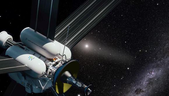
Hence the need to find alternative navigation systems, which can fulfill the task of identifying the exact position of space vehicles. Just like sailors of yore, who used the North Star as a reference point for crossing the ocean, future astronauts could reliance on press for positioning, navigation and the timing (PNT) in deep space.
 Le press are neutron stars which, thanks to the combination of their rotation and the magnetic field, are capable of emitting flashes of light and intense pulsating radio signals and other radiations with extremely precise cadences. They are, broadly speaking, like gods radio beacons placed in the universe. What happens today with GPS receivers, which use the signals sent by satellites of the specific positioning network, to determine their distance from said satellites and calculate their latitude, longitude and altitude, would happen with the receivers on board space vehicles, which would detect, measure and use the regular and extremely precise pulses emitted by press every few milliseconds to calculate their position in space.
Astrophysicists tell us that the press There are thousands known today, but it appears that only six or seven are capable of providing signals that are smooth enough and strong enough to be used for short-time measurements, as required for precision PNT functions. However, even such a small number could already enable reliable navigation through the cosmos in the future.
At the moment, the tools to detect the emissions of press they rely on X-rays, which do not penetrate Earth's atmosphere, making them useful only in space. However, there is the possibility that one day those X-ray signals could be converted and transmitted to terrestrial platforms, thus allowing them to be used for navigation anywhere, even on Earth (as a backup or to improve the accuracy of the GPS-based PNT). or in navigations around the Moon, for example. Since 2017, an experimental X-ray telescope, called Neutron Star Interior Composition Explorer (NICER), which is the size of a washing machine and is used to better understand the properties of neutron stars. The crews that have followed one another on the SSI have paired NICER with the flight as part of a called mission Station Explorer for X-ray Timing and Navigation Technology (SEXTANT), which uses observations from press X-ray to determine the exact orbital position of the space station. The team of SEXTANT successfully completed a first demo in November 2018. The European Space Agency is also evaluating the timing based on press to improve the accuracy of the data provided by the Galileo PNT satellite network.
 Conclusions
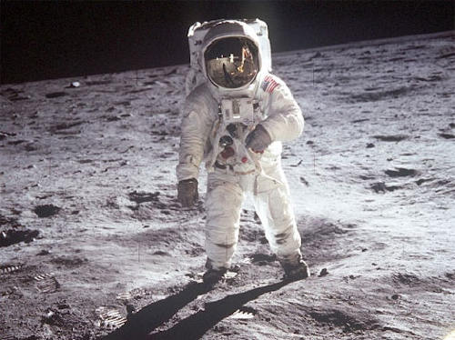
The journey into the unknown is one of the fantasies that tickles the minds of many who, since childhood, dream of emulating the exploits of Columbus, Magellan ... or Armstrong. Having by now explored the entire earth's surface, going into the unknown, into the depths of the universe that surrounds us, remains the most widespread fantasy. This leads us to look up and dream of pushing the boundaries of knowledge further and further away. On the maps of the ancient Romans there was an inscription indicating the areas of the planet not yet explored, too dangerous and unknown: hic sunt leones, from here on there are the beasts. It was an indication that the edge of the known world had been reached.
Centuries have passed but humanity continues to have the desire to sail towards the horizon, to overcome it, to explore the unknown. The horizon of knowledge, on the other hand, is like the horizon of the sea, it moves continuously forward. Here, our desire continues to be to explore, bringing that hic sunt leones ideally further and further, beyond the Moon, beyond Mars, beyond the confines of the solar system, into interstellar space.
Times, means and people change, but the drives for exploration of the unknown are the same and navigation systems, even if increasingly perfected and precise, are based on fairly common principles. Paraphrasing a quote attributed to Lucio Anneo Seneca, to "... There is no favorable route for the sailor who does not know where to go...", I would dutifully add ... and, above all, he does not know where he is ... The astronauts, in fact, who are sailing for scientific, commercial or military reasons, they need to know exactly where they are, in order to be able to navigate correctly to their destination.
We do not know how much time will still have to pass for the first space exploration beyond the solar system to be carried out. At the moment, the technology necessary for efficient propulsion to travel those great distances is lacking. While waiting for suitable thrusters, the work of the scientists continues, with the aim of increasing the number of press to be used as galactic clocks. By analyzing their signals in depth, the ones can be selected press which, over long time scales, ensure the same stability as laboratory atomic clocks and which do not move in a measurable way, with the instruments in our possession. This will allow future navigators of the unknown to know exactly where they are.
If up to now space travel and galactic explorations with artificial probes have brought human beings to knowledge of what until a century ago resided only in studies and observations made from the Earth or even in people's imagination, it is very likely future space travel, in addition to scientific purposes, will have significant economic motivations (search for or extraction of raw materials and energy resources), military or even (why not?) tourism. Without taking into account that in all probability, in times that probably won't even interest our great-grandchildren, it will perhaps be necessary to plan a permanent stay away from our planet.
To know where to go, therefore, it will be essential to have an in-depth knowledge of the universe but, above all, to be in possession of systems that allow us to know exactly where we are in space, a small but decisive detail, which will help future cosmonauts navigate towards the unknown, taking humanity towards new horizons.
i Emilio Francardi, Naval history notes, Naval Academy, Livorno, 1977
ii The name derives from the fact that its graduated arc has a width of one sixth of a circumference (60°). The optical principle that it uses is quite simple. If a light ray is reflected twice in the same plane by two plane mirrors, the angle by which it is deflected is equal to twice the angle between the two mirrors.
Image: NASA - Christopher Morrison / web / Elie plus / RAF