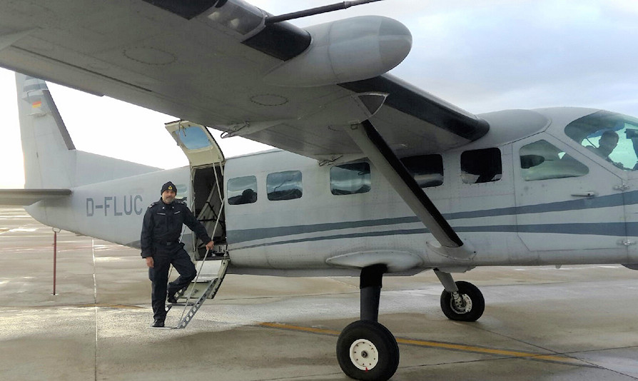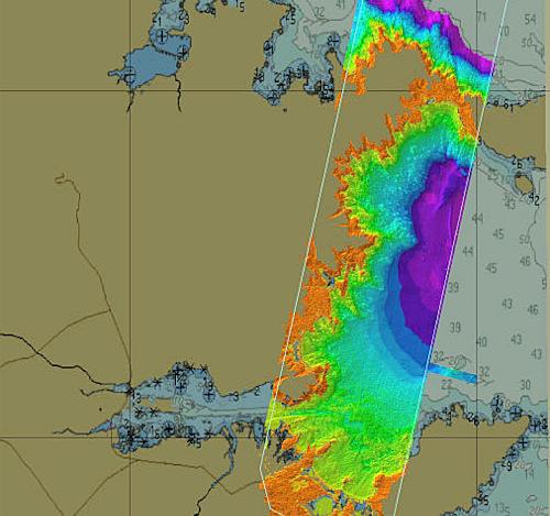
In the week from 6 to 10 November a team from the Hydrographic Institute of the Navy carried out the hydrographic survey of the Olbia roadstead, using LIDAR technology embarked on a plane for the first time. Of the two Navy hydrographers who made up the team that followed the survey operations, one operated on board the aircraft.
The airborne topo-bathymetric Lidar is an instrument capable of simultaneously detecting, with a single scan, both the emerged and the submerged part of the coastal strip. The technical characteristics of the system also allow the realization of hydrographic surveys in compliance with the standards of the International Hydrographic Organization (IHO), reducing execution times, thus supporting and integrating the traditional activities carried out with naval means.
The fields of application, in addition to those connected with the updating of nautical documentation, are also those related to the temporal variation of the coastal strip such as, for example, coastal erosion and the risk of Geohazard: the latter aspects, where the Institute Hydrographic of the Navy plays a key role, carrying out hydrographic surveys since 1871 and therefore having the possibility of evaluating changes in the territory with long-term historical series.
The first results are optimal and will be used to develop subsequent hydrographic campaigns using the same technology.